Survey Reporting Tool – Paginated Grid View
The Wyoming Pathways Active Transportation and Trails Community Needs Survey Reporting Tool Grid View displays the complete submission data from each respondent. The search results in this view are paginated, with 5 entries showing per page. If multiple projects were submitted by a single respondent, these are displayed as individual entries. To save these entries you can print them by using the “Print Search Results” link. If you would like the same data in a CSV format, please go to the Paginated Table View.
How to Search Survey Responses: We have provided multiple search categories to search the survey (Project Type, Trail Project Type, Nearest Town or City to project, Zip Code of Project, House District of Project, Respondent Representing and Respondent Town or City). You can search by individual or combinations of the search categories, but combining search terms will likely reduce the number of results returned.
If you find this tool useful, please consider making a donation to support our continued work to bring Active Transportation and Trail projects to Wyoming communities.
City of Town you live in or nearest to: Alpine
I am interested in: Multiple Types of Active Transportation Projects, Including Trails
And specifically:
Do you want to tell us about specific projects? Yes
Project Type: Sidewalk and/or Crosswalk Networks
Project Jurisdiction: Lincoln County?
Project Location (nearest Town or City or Statewide): Alpine
Project Location (description):
Alpine
Zip Code of Project: 83128
Project House District: H21-Lincoln County
Project Character of Work:
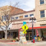
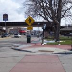
We need a cross walk to cross the main road across from the library. This would be near that one plaque as you drive into town heading from Etna. There are lots of kids in the neighborhood across from the library, and there isn’t a safe place to cross that is connected with sidewalks. Putting in a crosswalk here would allow families and individuals to take the safer backroad, Trail Drive, and then safely cross. The type with a flashing light could be extra beneficial because people are just driving into town, and haven’t slowed all the way down yet.
This would also provide safer access to the ball park, the path along the river, and Melvins.
With a beacon light it would be very expensive, so if that is prohibitive a high visibility cross walk, potentially with flags-like they have in Jackson- would be much safer than nothing.
Project Cost Estimate: Under $5,000
Additional Thoughts:
I sincerely appreciate the efforts of this organization. Creating pathways and trail systems with our smaller population is a large undertaking. I feel it is important and greatly adds to the quality and safety of life around here. Thank you for your dedication.
City of Town you live in or nearest to: Lander
I am interested in: Multiple Types of Active Transportation Projects, Including Trails
And specifically:
Do you want to tell us about specific projects? No
City of Town you live in or nearest to: Casper
I am interested in: Multiple Types of Active Transportation Projects, Including Trails
And specifically:
Do you want to tell us about specific projects? Yes
Project Type: Shared Use Pathways and Greenways
Project Jurisdiction: City of Casper
Project Location (nearest Town or City or Statewide): Casper
Project Location (description):
All over town.
Zip Code of Project: 82601, 82605, 82609, 82636, 82644
Project House District: H56-Natrona County
Project Character of Work:
We need to get the trails linked up with protected lanes. A two block stretch on Midwest seems glaringly obvious.
Project Cost Estimate: $25001-$50,000
Project Notes:
Casper needs to get in gear with it’s trails. The recreational trails are great, but they don’t really connect up in any meaningful way. The trail along Casper Mountain Road doesn’t connect to the painted bike gutters on Durbin Street. There’s a massive gap between the multiuse trail on CY and Morad Park as well as toward downtown. There’s a short gap along Midwest that would be obvious to be filled near the new state building. There’s a bad connect on the Rail trail near where Yellowstone and 1st cross. I could go on. It’s a good system that isn’t knitted into a system. Casper is about 10 miles of protected bike lanes and trails from being so much better for cycling as transportation. I know it’s not the usual mountain trails that WyoPath does, but this is the sort of thing that would impact people’s daily lives.
Additional Thoughts:
Connecting Casper to Glenrock via paved trail would also be cool.
City of Town you live in or nearest to: Thermopolis
I am interested in: Multiple Types of Active Transportation Projects, Including Trails
And specifically:
Do you want to tell us about specific projects? No
City of Town you live in or nearest to: Lander
I am interested in: Multiple Types of Active Transportation Projects, Including Trails
And specifically:
Do you want to tell us about specific projects? No


